News · 8 min read
Typhoon Champi: typhoon warning for Guam as a Category 2 storm heads for a near-direct hit on Sunday
Typhoon Champi is forecast to pass just south of Guam early Sunday 18 October as a Category 3 typhoon. Warnings, COR 1, rain, surge and shelters.
 By the Good Air teamUpdated · First published 15 October 2026
In this article · 9 sections
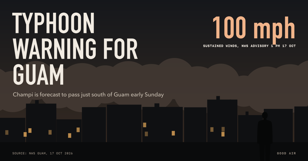
Guam and Rota are under a typhoon warning as Typhoon Champi (29W) closes in. At 1 pm Chamorro Standard Time (ChST) on Saturday 17 October 2026, Champi was a Category 2 typhoon with sustained winds of 100 mph, about 225 miles east-south-east of Guam, moving west-north-west at 18 mph. The National Weather Service (NWS) in Guam forecasts it to pass "just south of Guam as a Category 3 typhoon", with typhoon-force winds expected by Sunday morning, 18 October (NWS Guam advisory 11, 1:06 pm ChST 17 October).
Guam moved to Condition of Readiness 1 at 1 pm on Saturday, and residents of the southern coastal villages were told to move to higher ground (Public Radio Guam, 17 October). Tinian and Saipan are under a tropical storm warning and a typhoon watch.
Latest: 17 October
- Strength. Champi became a typhoon early on 17 October and strengthened from 85 mph at 7 am to 100 mph by 1 pm ChST. The NWS expects rapid intensification as it nears the Marianas. Typhoon-force winds extend up to 40 miles from the centre and tropical storm-force winds up to 125 miles.
- Southern Guam takes the worst. NWS meteorologist Landon Aydlett said the northern eyewall "will pass over the southern villages of Guam" even if the centre stays offshore, and that southern residents could see a stronger hit than Typhoon Mawar in 2023. "This is going to be a significant hit for us," he told Public Radio Guam (Public Radio Guam, 12:42 pm ChST 17 October).
- Be sheltered by sundown. Aydlett urged everyone to be in a hardened shelter, with reinforced concrete walls and roof, by sunset on Saturday. The Office of Civil Defense told people in metal-roof or container homes to move to concrete buildings, and asked residents of Humåtak, Malesso', Inalåhan and Talo'fo'fo' to relocate to higher ground. Shelters opened at Talofofo Elementary School and, from 2 pm, Inalåhan Middle School.
- Damage expected. The NWS warned that "most metal roof homes will be destroyed" and that "near total power loss is expected".
- Rain. A flood watch runs to 4 pm Sunday. The NWS forecasts 12 to 20 inches of rain on Guam, 10 to 15 inches on Rota and 4 to 6 inches on Tinian and Saipan over Sunday and Monday, less if the track shifts south.
- Surf and surge. A high surf and coastal flood warning runs from 5 pm Saturday to 4 am Monday: breaking waves up to 35 feet on Guam, 20 to 25 feet on Rota and 15 to 20 feet on Tinian and Saipan, and coastal inundation of 5 to 7 feet on Guam (NWS Guam alerts, 17 October).
- Northern Marianas. Rota is under Typhoon Condition II and Saipan and Tinian under Condition III (Marianas Variety, 17 October).
Where does Champi go after Guam?
After the Marianas, Champi is forecast to keep strengthening over the open Philippine Sea. Weathernews expected a "very strong" typhoon by 21 October, heading toward waters south of Japan's Ryukyu Islands (Weathernews, 16 October). Taiwan's Central Weather Administration said it would most likely turn north after passing the Ryukyus, with possible rain in northern and eastern Taiwan the following weekend (Taipei Times, 16 October). Those forecasts are five or more days out and will change. As of 17 October no agency had forecast a landfall in the Philippines, Taiwan or Japan.
Earlier forecasts: 15 and 16 October
The sections below were written on 15 and 16 October, when Champi was a tropical storm and only a typhoon watch was in force. We have kept them for the timeline and the preparation advice.
Guam, Rota, Tinian and Saipan are under a typhoon watch as Tropical Storm Champi (29W) moves toward the Mariana Islands. The National Weather Service (NWS) in Guam says damaging winds are likely late on Saturday night and on Sunday, 17 and 18 October 2026 local time, with the strongest winds toward the southern islands. The Joint Typhoon Warning Center (JTWC) forecasts sustained winds of about 85 knots, roughly 98 mph, near the centre. That is Category 2 strength on the US hurricane scale.
A typhoon watch means typhoon conditions, winds of 74 mph (64 knots) or more, are possible within 48 hours. Guam moved to Condition of Readiness 3 on Thursday 15 October, meaning damaging winds are possible within 48 hours, and the watch was first issued that afternoon (Public Radio Guam, 15 October).
Where is Champi now?
At 7 pm Chamorro Standard Time (ChST) on Thursday 15 October, the centre of Champi, then a tropical depression, was about 890 miles east of Guam. It was moving west-north-west at 10 mph with winds of 35 mph, according to the NWS Guam local statement in Good Air's feed of NWS alerts. By the NWS marine statement at 12:25 am ChST on Friday 16 October, Champi had become a tropical storm. The NWS expects it to turn west on Friday and to strengthen as it approaches, moving through the region "as at least a category 1 typhoon, but more likely stronger".
Guam is 4 hours 30 minutes ahead of India and 14 hours ahead of US Eastern time.
The NWS warns readers not to focus on the exact track: "It is vital that you do not focus on the exact forecast track." Public Radio Guam reported that it may pass between Guam and Rota late on Saturday night into Sunday, and that residents of Guam and the Northern Marianas are being told to prepare for a Category 2 typhoon.
When will Champi reach Guam and Saipan?

| When (ChST) | What the forecasters expect |
|---|---|
| Thursday 15 October | Typhoon watch for Guam, Rota, Tinian and Saipan; Guam in Condition of Readiness 3 |
| Friday 16 October | Champi turns west and strengthens; shelter announcements could come in the CNMI |
| Late Saturday 17 October | Damaging winds begin; seas and surf dangerous |
| Sunday 18 October | Typhoon-force winds possible near the centre, strongest toward the southern islands |
| Saturday to Monday | 5 to 8 inches of rain, locally up to 12 inches; risk of floods and mudslides |
Sources: NWS Guam local statement and hydrologic outlook; Marianas Variety, 15 October.
Tropical storm-force winds could reach about 150 miles from the centre, so Saipan and Tinian would still feel them even if the eye passes to the south, said Miguel Dandan, acting public information officer for the CNMI Joint Information Center. He said the forecast track resembles that of Typhoon Mawar in 2023 and that the cone of uncertainty is still wide (Marianas Variety, 15 October).
How much rain and how big will the waves be?
NWS Guam's hydrologic outlook forecasts 5 to 8 inches of rain from Saturday to Monday, with localised totals up to 12 inches. Soils will become saturated, which raises the risk of mudslides, and flood watches or flash flood warnings may follow over the weekend. People who live near streams should move belongings away from the banks, and those in low-lying areas should clear storm drains.
At sea, the NWS typhoon watch for the coastal waters of Guam, Rota, Tinian and Saipan runs through at least Sunday night. It warns of destructive winds and seas that "could damage, capsize or sink vessels". Mariners are told to stay in port or secure their boats.
What do Condition of Readiness and a typhoon watch mean?
Guam and the CNMI use two scales side by side:
- NWS watch and warning. A typhoon watch means typhoon conditions are possible within 48 hours. A typhoon warning means they are expected, and is the signal to finish preparing.
- Condition of Readiness (COR). Guam's government sets the COR. COR 3, in force since 15 October, means damaging winds are possible within 48 hours, according to the NWS. In the CNMI, a watch moves the islands to Typhoon Condition 3 and a warning to Condition 2 (Marianas Variety, 15 October).
As of the morning of 16 October ChST, no typhoon warning had been issued. Our US weather alerts page lists every active NWS alert, including Guam's.
How to prepare for Typhoon Champi
From the NWS, The Guam Daily Post's NWS briefing and the CNMI Joint Information Center:
- Decide now where you will shelter. The NWS says people in metal-roof or container homes, in surge zones or in flood-prone places should go to a designated shelter or to the sturdy home of family or friends.
- Stock up for several days: water, non-perishable food, medicines, batteries, torches and power banks. Fuel vehicles and generators.
- Get cash. Card systems may go down after the storm.
- Secure your home. Tie down or bring in outdoor items; clear drains.
- Protect documents and records. Keep papers in watertight bags and photograph your home before the storm for insurance or aid claims.
- Plan for medical needs. People who rely on electricity for medical equipment should make plans with their providers now.
- Shelter kit. The NWS list includes a first aid kit, prescriptions, baby food and nappies, a battery radio, a phone, torches, a blanket or sleeping bag for each person and identification.
Dandan said every island should prepare whatever the track, because infrastructure has been weakened by this year's earlier storms. Earlier in the week, NWS Guam meteorologist Taelor Mesa told The Guam Daily Post that the system showed "good signs that it will gain strength" (Guam Daily Post, 14 October).
Why the Pacific is so active this year
NOAA says El Niño tends to boost tropical storm development in the eastern and central Pacific, and this year's El Niño is heading for a strong to very strong peak. Champi formed in the central-western Pacific, passing Pohnpei and Kosrae before heading for the Marianas. Our explainer on El Niño and winter 2026 covers the forecasts. Whether El Niño is shaping Champi's track or strength in particular is not something forecasters have said.
After a typhoon, clean-up dust and burning debris can affect the air for days. Our guide to PM2.5 vs PM10 explains the particles involved.
Frequently asked questions
When will Typhoon Champi hit Guam?
The National Weather Service in Guam expected tropical storm-force winds from Saturday night 17 October 2026 and typhoon-force winds by Sunday morning 18 October, local time, as Champi passes just south of the island. Sea and surf conditions were expected to start improving on Sunday night into Monday.
How strong is Typhoon Champi?
At 1 pm Guam time on 17 October 2026, Champi was a Category 2 typhoon with sustained winds of 100 mph, according to the National Weather Service. It was forecast to strengthen to Category 3 before passing just south of Guam, and to keep strengthening over the Philippine Sea afterwards.
What is the difference between a typhoon watch and a typhoon warning?
A typhoon watch means typhoon conditions, with sustained winds of 74 mph or more, are possible within 48 hours. A typhoon warning means those conditions are expected, and preparations should be finished. Guam and Rota moved from a watch to a warning on 17 October 2026, while Tinian and Saipan remained under a typhoon watch.
What does COR 1 mean on Guam?
Condition of Readiness 1 is the highest of the alert levels Guam's government sets before a storm, used when damaging winds are close. Guam moved to COR 1 at 1 pm on 17 October 2026 as Typhoon Champi approached, two days after COR 3. The National Weather Service urged everyone to be in a reinforced concrete shelter by sunset that evening.
How much rain will Guam get from Champi?
The National Weather Service forecast 12 to 20 inches of rain on Guam, 10 to 15 inches on Rota and 4 to 6 inches on Tinian and Saipan over Sunday and Monday, 18 and 19 October 2026. A flood watch was in force, and a track further south would reduce the totals.