News · 8 min read
Arizona flood watch: Phoenix and the Four Corners face flash flooding through Thursday after the state's first tornado watch since 2010
Arizona flood watch, October 2026. Flash flooding is possible in Phoenix and Flagstaff until Thursday 22 October, with watches in Utah, Colorado and New Mexico.
 By the Good Air team

In this article · 8 sections
A flood watch covers most of Arizona in October 2026, including metro Phoenix until 5 pm MST on Thursday 22 October and all of northern and central Arizona until 11 pm MST Thursday. The National Weather Service (NWS) warns of rain rates of 1 to 2 inches an hour in the Phoenix area as a strong Pacific storm pulls tropical moisture across the Southwest (NWS Phoenix, 21 October).
The same storm put northern Arizona under a tornado watch until 6 pm MST on Wednesday 21 October, the first tornado watch in Arizona since two were issued on 6 October 2010, according to the NWS (KTAR, 21 October). Flood watches also run across southern Utah, south-west Colorado, western New Mexico, Southern California and burn scars in Idaho, most until Thursday night or Friday 23 October.
This article was written at about 1 pm MST on Wednesday 21 October, from NWS forecasts issued that morning. Forecasts change; check the live Arizona weather alerts page for the current list.
Where are the flood watches, and until when?
A flood watch means conditions could lead to flooding; a flood or flash flood warning means flooding is happening or about to. These watches and warnings were in force at about 1 pm MST on 21 October, from Good Air's feed of NWS alerts:
| State | Alert | Areas | Until (local time) |
|---|---|---|---|
| Arizona | Flood watch | Metro Phoenix: Central and North Phoenix, Glendale, Scottsdale, Deer Valley, the East Valley, Buckeye, Queen Creek, Apache Junction | 5 pm MST Thursday 22 Oct |
| Arizona | Flood watch | Tonto Basin, Globe and Miami, Superior, Superstition and Mazatzal mountains | 11 pm MST Thursday |
| Arizona | Flood watch | All of northern and central Arizona, including Flagstaff, the Grand Canyon and the Mogollon Rim | 11 pm MST Thursday |
| Arizona | Flood watch | Pinal County (Eloy, Kearny, Oracle), Safford, Clifton and the White Mountains | 5 pm to 10 pm MST Thursday |
| Arizona | Tornado watch 688 | Coconino, Navajo, Yavapai and Mohave counties, including Flagstaff, Prescott, Sedona, Winslow, Kingman and Bullhead City | 6 pm MST Wednesday 21 Oct |
| Utah | Flood watch | Southern and central Utah, including Zion, Bryce Canyon, Capitol Reef, Lake Powell and lower Washington County (St. George) | Midnight MDT Thursday night |
| Utah | Flood warning | Kane, south-west Garfield and San Juan counties, including Glen Canyon | 12:15 pm MDT Thursday |
| Colorado | Flood watch | San Juan Mountains, Animas and San Juan river basins, Four Corners, plus Arches, Canyonlands and the La Sal and Abajo mountains in Utah | Noon MDT Friday 23 Oct |
| Colorado | Flood watch | Eastern San Juan Mountains and Upper Rio Grande Valley | 6 pm MDT Friday |
| New Mexico | Flood watch | Western and north-central New Mexico, west of the Continental Divide, including the Northwest Plateau, Chuska Mountains and Chama | 6 am MDT Friday |
| New Mexico | Flood watch | Silver City, Grant County and the Gila region | Thursday afternoon to 6 am MDT Friday |
| California | Flood watch | Santa Barbara County coast and mountains, Malibu Coast, Santa Monica Mountains | 4 pm PDT Thursday |
| California | Flood watch | Bakersfield, Kern River Valley, Tehachapi, Grapevine, Mojave Desert | 8 pm PDT Thursday |
| Idaho | Flash flood watch | Wapiti, Crooked, Big Rock and Ohio fire burn scars | Thursday evening to Friday |
Live pages for each state: Utah, Colorado, New Mexico, California and Idaho. The full list is on our US weather alerts page.
How much rain will fall?
The NWS Weather Prediction Center (WPC) gave much of the Southwest and Four Corners a slight risk (level 2 of 4) of flooding rain on Wednesday and raised south-west Colorado to a moderate risk (level 3 of 4) for Thursday. It said rain rates of up to 2.5 inches an hour are possible, with cities, burn scars, slot canyons and dry washes most at risk (WPC, 21 October).
Rain forecasts from the local NWS offices on 21 October:
- Phoenix: 1 to 2 inches on the higher ground north and east of Phoenix and 0.25 to 0.75 inch in the lower deserts, more where storms train over the same area. The heaviest rain is expected from Wednesday evening through Thursday morning (NWS Phoenix, 10:58 am MST).
- Northern Arizona: several rounds of heavy rain on soils that are already "very saturated", so rivers, streams and dry washes may run high for longer (NWS Flagstaff, 12:35 pm MST). At 11:02 am MST, a gauge on the Moenkopi Wash in Coconino County rose about 8 feet, and the NWS issued a flash flood warning there until 3 pm, from Good Air's NWS alert feed.
- South-west Colorado: 1 to 3 inches in the southern mountains and 2 to 4 inches or more in the San Juan Mountains and southern foothills. Some main rivers are forecast to crest on Friday morning (NWS Grand Junction, 21 October).
- Southern Utah: locally more than 3 inches through Thursday. A flash flood warning covered Zion Canyon until 4 pm MDT on Wednesday (NWS Salt Lake City, 21 October).
- New Mexico: 0.75 to 1.5 inches in most areas west of the Continental Divide through Thursday night. Albuquerque's weather balloon measured 1.03 inches of precipitable water at midday, a record for the date (NWS Albuquerque, 21 October).
- Southern California: mostly 1 to 1.5 inches, with up to 3 inches in the Santa Ynez and Santa Monica mountains (NWS Los Angeles, 21 October).
What about tornadoes and hail?
The Storm Prediction Center (SPC) put parts of central Arizona under an enhanced risk (level 3 of 5) of severe storms on Wednesday, with hail of 2 inches or more, a few tornadoes and damaging winds (SPC, 21 October). NWS Phoenix called the set-up "highly unusual" for the region and warned of gusts of 60 to 70 mph.
- Tornado warnings. The NWS issued radar-based tornado warnings on Wednesday morning for areas near Bellemont, Prescott and Prescott Valley, Jerome, Flagstaff and Valle. As of 12:18 pm MST, the NWS had not confirmed that any tornado touched down (FOX 10 Phoenix, 21 October). Arizona's Family reported that its chief meteorologist confirmed a tornado formed over Dewey-Humboldt, with no damage reported (Arizona's Family, 21 October).
- People in the watch. The tornado watch covered more than 675,000 residents, 355 schools and 20 hospitals, the NWS said (KTAR, 21 October).
- Mesa. A supercell storm crossed the East Valley from Chandler to Mesa on Tuesday night with several reports of large hail (NWS Phoenix). At Quail Run Park in Mesa, trees were uprooted and ballfield lights toppled (Arizona's Family).
- Thursday. The SPC's risk moves to south-east Arizona, with hail up to about 2 inches and a couple of tornadoes possible before storms merge into lines with damaging wind (SPC day 2, 21 October).
When will the rain stop?

- Thursday 22 October. The storm moves inland over the Great Basin. Rain ends first in the Phoenix lower deserts by mid to late afternoon, and on the higher ground late Thursday night into early Friday (NWS Phoenix). A cold front then brings much drier air to northern Arizona (NWS Flagstaff).
- Friday 23 October. Rain fades in south-west Colorado and south-east Utah, but the flood risk stays raised while water drains through rivers (NWS Grand Junction). In Southern California, a weak Santa Ana wind is forecast, with peak winds around 35 mph in the windiest spots (NWS Los Angeles).
- The weekend. Phoenix expects quieter, cooler weather, with a few showers possible on the Arizona high ground on Saturday. NWS Albuquerque says more heavy rain and flash flooding are possible in eastern New Mexico over the weekend.
Will it snow?
Only high up. Winter weather advisories cover the Sierra Nevada above 8,000 feet, with a 70% chance of 4 inches or more on Tioga Pass until 11 am PDT Thursday, and Mono County, with 4 to 8 inches above 8,000 feet until 5 pm PDT Thursday, from Good Air's NWS alert feed. NWS Grand Junction expects 6 to 12 inches or more on the highest San Juan peaks, and NWS Salt Lake City 1 to 4 inches above 9,000 feet in northern and central Utah on Friday.
What to do in a flash flood
The advice here comes from the NWS:
- Have a way to get warnings, and act at once if a flash flood warning is issued for your area (NWS Flagstaff flood watch).
- Turn around, don't drown. Six inches of fast water can knock an adult off their feet, and 12 inches can carry away most cars. Never drive around barriers on a flooded road (NWS, flood safety).
- Stay out of slot canyons, washes and creeks. In a warning, move to higher ground now (NWS Salt Lake City flash flood warning for Zion).
- In the backcountry, plan a second route in case your road washes out (NWS Salt Lake City flood watch).
- Near a burn scar, be ready for debris flows and follow local officials (NWS Pocatello and Boise flash flood watches).
What about air quality?
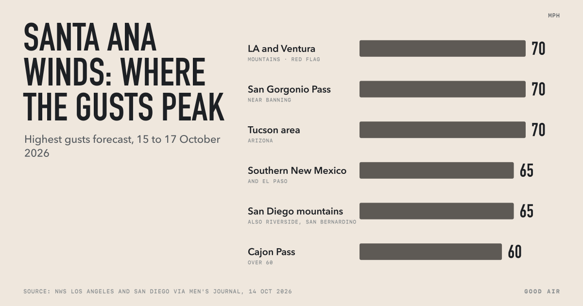
This storm brings rain, not smoke, but dust has been the recent air problem here. Among the 10 cities in the storm area that we track, the worst recent day was Thursday 16 October in Tucson, during last week's dry wind event (see our Santa Ana winds report):
| City | Worst day, 14 to 20 Oct | Daily AQI | 20 Oct | Live, 21 Oct |
|---|---|---|---|---|
| Tucson | 16 Oct | 140 | 38 | 46 |
| Phoenix | 17 Oct | 82 | 52 | 60 |
| Flagstaff | 20 Oct | 56 | 56 | 18 |
| St. George | 17 Oct | 38 | 27 | 30 |
| Farmington | 14 Oct | 35 | 29 | 29 |
On 16 October, Tucson's average AQI of 140 was Unhealthy for Sensitive Groups, and the South Tucson monitor averaged 179 µg/m³ of PM10, the coarse dust particles explained in PM2.5 vs PM10. In Phoenix, the JLG Supersite monitor averaged 77 µg/m³ of PM10 on 17 October, about five times its 14 October level of 16. By 20 October, all five were Good or Moderate. At about 12:40 pm MST on 21 October, Phoenix read 60 (Moderate) with PM10 as the main pollutant. We will add what the monitors show once the rain clears.
Each city page shows the live reading and, where one exists, AirNow's daily forecast for tomorrow. Albuquerque, Los Angeles and Bakersfield are also in the storm area; see all cities on our US air quality page, and the autumn ranking in the most polluted US cities this autumn.
How we measured
- Data. Hourly US AQI that the EPA's AirNow system publishes for each city, and PM10 from AirNow's South Tucson and Phoenix JLG Supersite monitors, collected by Good Air. Government monitors only.
- Daily value. The mean of that day's hourly readings, in UTC days, counted only with at least 12 hours; every day here had 22 to 24. This can differ a little from AirNow's official daily AQI.
- Cities. Phoenix, Tucson, Flagstaff, Prescott Valley, Kingman, St. George, Farmington, Albuquerque, Los Angeles and Bakersfield, 14 to 20 October 2026. Live readings are from Good Air's feed at 19:40 UTC on 21 October.
Frequently asked questions
When does the Arizona flood watch end?
The NWS flood watch for metro Phoenix runs until 5 pm MST on Thursday 22 October 2026. Watches for northern and central Arizona, the Tonto Basin and Globe run until 11 pm MST Thursday, and those for Pinal, Graham and Greenlee counties end between 5 pm and 10 pm MST Thursday. Drier air is forecast from Friday 23 October.
How much rain will Phoenix get?
NWS Phoenix forecast 0.25 to 0.75 inch for the lower deserts, including the Phoenix metro area, and 1 to 2 inches on the higher ground north and east of Phoenix, from Wednesday 21 to Thursday 22 October 2026. Storms that train over the same area could bring more, with rates of 1 to 2 inches an hour.
Is there a tornado watch in Arizona?
Tornado watch 688 covered Coconino, Navajo, Yavapai and Mohave counties in Arizona until 6 pm MST on Wednesday 21 October 2026. It was the first tornado watch in Arizona since 6 October 2010, the NWS said. On Thursday 22 October, the Storm Prediction Center saw a risk of a couple of tornadoes in south-east Arizona.
What is the difference between a flood watch and a flash flood warning?
A flood watch from the National Weather Service means rain could cause flooding, so you should be ready to act. A flash flood warning means flooding is happening or about to start in that area, and you should move to higher ground at once. Never drive into flood water: 12 inches of it can carry away most cars.
Which states are under flood watches?
On 21 October 2026, NWS flood watches covered parts of Arizona, Utah, Colorado, New Mexico and California, and flash flood watches covered wildfire burn scars in Idaho. The Weather Prediction Center rated south-west Colorado at a moderate risk (level 3 of 4) of flooding rain on Thursday 22 October.